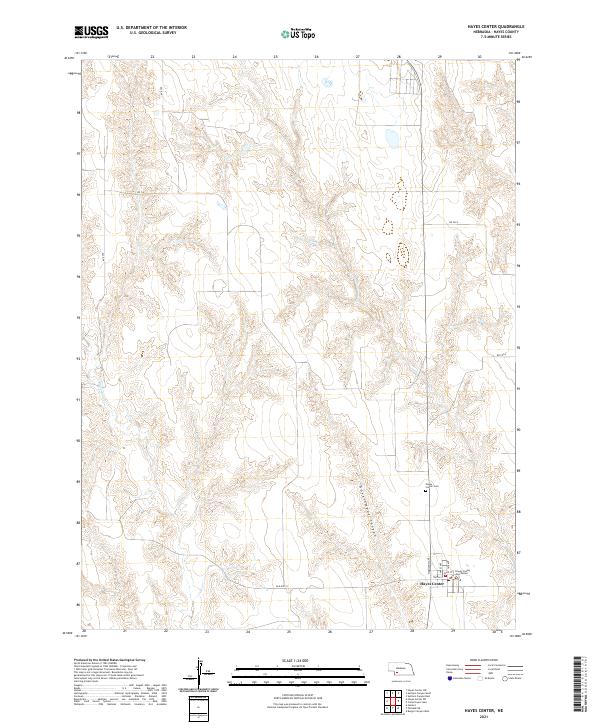
2021 Map of Hayes Center
USGS Topo · Published 2021About this map
Hayes Center serves as the focal point of this southwestern Nebraska survey, situated at the intersection of local routes like Old Hwy 17 and Hayes Ave. The town’s status as a civic hub is anchored by the Hayes County Courthouse, surrounded by a grid of streets including Dyer St, Troth St, and Tate Ave. To the north, the landscape is defined by the deep incisions of Government Canyon and the winding course of Blackwood Cr, illustrating the rugged topography that shapes the agricultural layout of the High Plains.
Find a feature on this map
25 named features on this map. Tap any name to fly to it.
Don’t see what you’re looking for? This feature index may not catch every label — zoom into the map to look around manually.
Map Details
Editions of this 2021 Hayes Center Map
This is the sole edition of this map. No revisions or reprints were ever made.
Other maps of this area

1954 · McCook
USGS Topo · 1:250,000

1957 · McCook
USGS Topo · 1:250,000

1958 · McCook
USGS Topo · 1:250,000

1973 · Suttlers Canyon East
USGS Topo · 1:24,000

1973 · Suttlers Canyon West
USGS Topo · 1:24,000

1973 · Hayes Center NW
USGS Topo · 1:24,000
1973 · Burger Canyon West
USGS Topo · 1:24,000

1974 · Hamlet
USGS Topo · 1:24,000

1974 · Hayes Center
USGS Topo · 1:24,000
1974 · Palisade NE
USGS Topo · 1:24,000