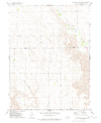
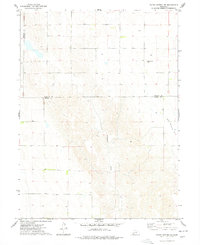
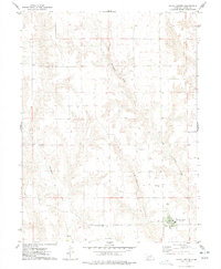
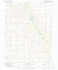
1973 Map of Suttlers Canyon West
USGS Topo · Published 1977About this map
The border between Lincoln Co and Hayes Co divides this rural Nebraska landscape, where the high plains terrain is defined by the incision of Suttlers Canyon. In the northern reaches, Red Willow Creek meanders through the breaks, near where the Lakeview Sch once served the local ranching families. The map illustrates a transitional era in communication, noting a prominent Radio Tower (KWNB) and another unnamed Radio Tower on the western edge. Most of the quadrangle is occupied by the headwaters of Little Blackwood Creek, showing a sparsely populated territory where early land divisions and section lines provide a geometric contrast to the natural drainages of the canyon country.
Find a feature on this map
7 named features on this map. Tap any name to fly to it.
Don’t see what you’re looking for? This feature index may not catch every label — zoom into the map to look around manually.
Map Details
Editions of this 1973 Suttlers Canyon West Map
This is the sole edition of this map. No revisions or reprints were ever made.
Other maps of this area

1954 · McCook
USGS Topo · 1:250,000
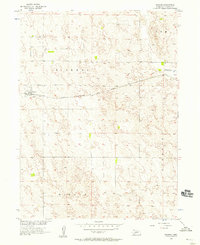
1956 · Dickens
USGS Topo · 1:24,000

1957 · McCook
USGS Topo · 1:250,000

1958 · McCook
USGS Topo · 1:250,000
1973 · Suttlers Canyon East
USGS Topo · 1:24,000

1973 · Melton Ranch Airport
USGS Topo · 1:24,000
1973 · Wallace
USGS Topo · 1:24,000
1973 · Hayes Center NW
USGS Topo · 1:24,000
1974 · Hayes Center
USGS Topo · 1:24,000
1974 · Camp Hayes Lake
USGS Topo · 1:24,000