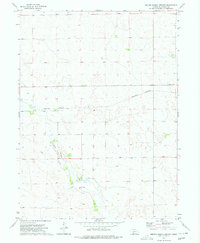
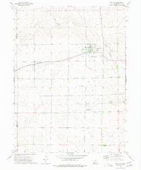
1973 Map of Melton Ranch Airport
USGS Topo · Published 1977About this map
Dry Red Willow Creek meanders through this portion of Lincoln County during the early 1970s, carving a drainage pattern through the Nebraska sandhills. The landscape is defined by the logistics of ranching and early energy exploration, evidenced by the presence of Oil Wells and a isolated Well scattered across the township lines. The small settlement of Dickens sits in the northeast corner, serving as a quiet focal point for the surrounding rural sections.
Find a feature on this map
7 named features on this map. Tap any name to fly to it.
Don’t see what you’re looking for? This feature index may not catch every label — zoom into the map to look around manually.
Map Details
Editions of this 1973 Melton Ranch Airport Map
This is the sole edition of this map. No revisions or reprints were ever made.
Other maps of this area

1954 · McCook
USGS Topo · 1:250,000

1956 · Dickens
USGS Topo · 1:24,000

1957 · McCook
USGS Topo · 1:250,000

1958 · McCook
USGS Topo · 1:250,000
1970 · Dickens NW
USGS Topo · 1:24,000

1973 · Suttlers Canyon East
USGS Topo · 1:24,000

1973 · Suttlers Canyon West
USGS Topo · 1:24,000
1973 · Wallace NE
USGS Topo · 1:24,000
1973 · Wallace NW
USGS Topo · 1:24,000
1973 · Wallace
USGS Topo · 1:24,000