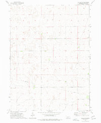
1973 Map of Wallace NE
USGS Topo · Published 1977About this map
Sykes Cem sits at the heart of this Lincoln County landscape, a quiet marker of early Nebraska settlement within the undulating sandhills topography. Recorded during a 1973 survey by the U.S. Geological Survey, the map illustrates a sparsely populated region where infrastructure is largely dictated by resource management. A prominent Pipeline cuts across the southern sections of the township, signaling the industrial overlay on this pastoral terrain. Scattered throughout the quadrangle, several locations marked simply as Well indicate the critical importance of groundwater access for the ranching and farming operations that define the area's economy. The grid-like section lines provide a clear view of the rural land divisions used during this era, offering a precise look at the development of these High Plains grasslands before later modern expansions.
Find a feature on this map
3 named features on this map. Tap any name to fly to it.
Don’t see what you’re looking for? This feature index may not catch every label — zoom into the map to look around manually.
Map Details
Editions of this 1973 Wallace NE Map
This is the sole edition of this map. No revisions or reprints were ever made.
Other maps of this area

1898 · Paxton
USGS Topo · 1:125,000

1899 · North Platte
USGS Topo · 1:125,000

1901 · Paxton
USGS Topo · 1:125,000

1902 · North Platte
USGS Topo · 1:125,000

1954 · McCook
USGS Topo · 1:250,000

1954 · North Platte
USGS Topo · 1:250,000

1956 · North Platte
USGS Topo · 1:250,000

1956 · Dickens
USGS Topo · 1:24,000

1957 · North Platte
USGS Topo · 1:250,000

1957 · McCook
USGS Topo · 1:250,000