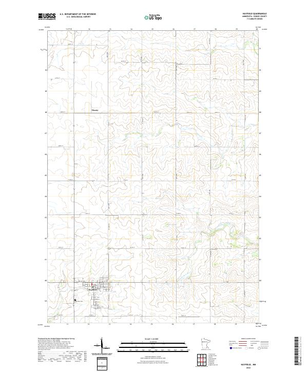
2022 Map of Hayfield
USGS Topo · Published 2022About this map
The city of Hayfield serves as the primary hub of this Dodge County landscape, characterized by a precise grid of agricultural roads and the winding paths of local waterways. Established around a compact downtown core including Main St and Center Ave S, the town is surrounded by fertile plains drained by Salem Cr and the S Fork Zumbro River. North of the main settlement, the smaller locality of Vlasaty sits along Co Rd 1, marking a distinct point in the rural surveying of T106N R17W.
Find a feature on this map
35 named features on this map. Tap any name to fly to it.
Don’t see what you’re looking for? This feature index may not catch every label — zoom into the map to look around manually.
Map Details
Editions of this 2022 Hayfield Map
This is the sole edition of this map. No revisions or reprints were ever made.
Other maps of this area

1953 · Saint Paul
USGS Topo · 1:250,000

1954 · Mason City
USGS Topo · 1:250,000
1955 · High Forest
USGS Topo · 1:62,500

1957 · Mason City
USGS Topo · 1:250,000

1958 · Mason City
USGS Topo · 1:250,000

1959 · Saint Paul
USGS Topo · 1:250,000
1965 · Dodge Center
USGS Topo · 1:24,000
1965 · Claremont
USGS Topo · 1:24,000
1965 · Byron
USGS Topo · 1:24,000
1966 · Waltham
USGS Topo · 1:24,000