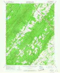
1965 Map of Hayfield
USGS Topo · Published 1968About this map
North Mountain and Great North Mountain dominate this mid-1960s landscape, where Frederick County's ridgeline terrain gives way to localized settlement and small-scale industry. The Winchester and Western RR cuts across the northeastern quadrant, serving the community of Hayfield and passing near several local landmarks including Mt Olive Ch and a Lookout Tower on the high ground.
Find a feature on this map
59 named features on this map. Tap any name to fly to it.
Don’t see what you’re looking for? This feature index may not catch every label — zoom into the map to look around manually.
Map Details
Editions of this 1965 Hayfield Map
3 editions found
Other maps of this area

1894 · Winchester
USGS Topo · 1:125,000

1914 · Gerrardstown
USGS Topo · 1:48,000

1916 · Gerrardstown
USGS Topo · 1:62,500

1916 · Capon Bridge
USGS Topo · 1:62,500

1923 · Middletown
USGS Topo · 1:62,500

1923 · Capon Bridge
USGS Topo · 1:62,500

1937 · Capon Bridge
USGS Topo · 1:48,000

1937 · Gerrardstown
USGS Topo · 1:48,000

1937 · Middletown
USGS Topo · 1:48,000

1938 · Winchester
USGS Topo · 1:48,000