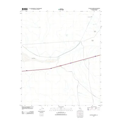
2012 Map of Hayfield Spring
USGS Topo · Published 2012About this map
Skylark Ranch and the vital desert water source of Hayfield Spring define this remote stretch of Riverside County. The landscape is a study in 20th-century water engineering, dominated by the massive Colorado River Aqueduct and the nearby Hayfield Lake. These infrastructure projects transformed the arid region, supported by subterranean features like the West Eagle Mountain Tunnel.
Find a feature on this map
15 named features on this map. Tap any name to fly to it.
Don’t see what you’re looking for? This feature index may not catch every label — zoom into the map to look around manually.
Map Details
Editions of this 2012 Hayfield Spring Map
This is the sole edition of this map. No revisions or reprints were ever made.
Other maps of this area

1940 · Canyon Spring
USGS Topo · 1:62,500

1943 · Canyon Spring
USGS Topo · 1:62,500

1943 · Coxcomb Mountains
USGS Topo · 1:62,500

1944 · Eagle Tank
USGS Topo · 1:62,500

1944 · Chuckwalla Mountains
USGS Topo · 1:62,500

1944 · Coxcomb Mountains
USGS Topo · 1:62,500

1954 · Salton Sea
USGS Topo · 1:250,000

1955 · Salton Sea
USGS Topo · 1:250,000

1959 · Salton Sea
USGS Topo · 1:250,000

1963 · Salton Sea
USGS Topo · 1:250,000