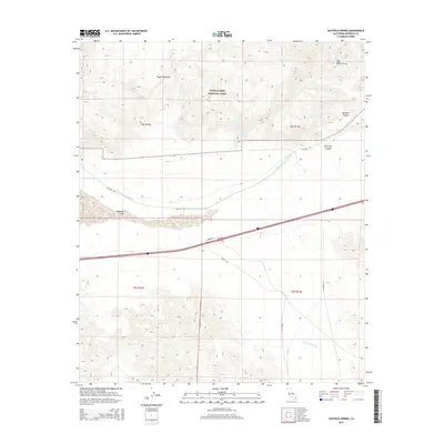
2015 Map of Hayfield Spring
USGS Topo · Published 2015About this map
Joshua Tree National Park encompasses the northern half of this desert landscape, where the Eagle Mountains rise sharply above the basin floor. A vital piece of California water infrastructure, the Colorado River Aqueduct, traverses the center of the sheet, entering the West Eagle Mountain Tunnel as it heads toward the coast. The southern reaches of the map are defined by the ephemeral Hayfield Lake and the wide alluvial plains of Red Cloud Wash. This area represents a critical intersection of natural wilderness and the engineered systems required to sustain regional development. Geographic landmarks like Hayfield Spring and Hayfield Summit Spring indicate the locations of precious water sources in an otherwise arid environment, while the steep grades of Difficult Canyon and Boulder Canyon showcase the complex drainage patterns of the Colorado Desert.
Find a feature on this map
19 named features on this map. Tap any name to fly to it.
Don’t see what you’re looking for? This feature index may not catch every label — zoom into the map to look around manually.
Map Details
Editions of this 2015 Hayfield Spring Map
This is the sole edition of this map. No revisions or reprints were ever made.
Other maps of this area

1940 · Canyon Spring
USGS Topo · 1:62,500

1943 · Canyon Spring
USGS Topo · 1:62,500

1943 · Coxcomb Mountains
USGS Topo · 1:62,500

1944 · Eagle Tank
USGS Topo · 1:62,500

1944 · Chuckwalla Mountains
USGS Topo · 1:62,500

1944 · Coxcomb Mountains
USGS Topo · 1:62,500

1954 · Salton Sea
USGS Topo · 1:250,000

1955 · Salton Sea
USGS Topo · 1:250,000

1959 · Salton Sea
USGS Topo · 1:250,000

1963 · Salton Sea
USGS Topo · 1:250,000