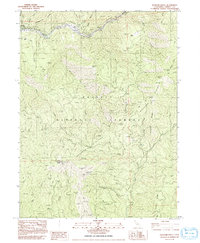
1982 Map of Hayfork Bally
USGS Topo · Published 1992About this map
Trinity River dominates the northern reaches of this territory, where the settlement of Big Bar sits along its banks. The landscape is defined by the steep elevation changes of the Trinity National Forest, marked by prominent ridgelines such as Hayfork Divide and Limestone Ridge. A network of 4WD trails provides the primary access through these wooded slopes, connecting high-altitude points like the Hayfork Bally Lookout with secluded water sources including Love Letter Spring and Squaw Camp Spring.
Find a feature on this map
38 named features on this map. Tap any name to fly to it.
Don’t see what you’re looking for? This feature index may not catch every label — zoom into the map to look around manually.
Map Details
Editions of this 1982 Hayfork Bally Map
2 editions found
Other maps of this area

1909 · Big Bar
USGS Topo · 1:96,000

1915 · Big Bar and Vicinity
USGS Topo · 1:250,000

1951 · Hayfork
USGS Topo · 1:62,500

1951 · Helena
USGS Topo · 1:62,500

1951 · Hyampom
USGS Topo · 1:62,500

1951 · Ironside Mountain
USGS Topo · 1:62,500

1958 · Redding
USGS Topo · 1:250,000

1982 · Helena
USGS Topo · 1:24,000
1982 · Big Bar
USGS Topo · 1:24,000
1982 · Hayfork Bally
USGS Topo · 1:24,000