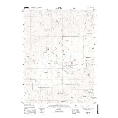
2015 Map of Hayfork
USGS Topo · Published 2015About this map
The Hayfork Valley serves as a central hub in this high-altitude landscape within the Trinity National Forest and Shasta National Forest. The settlement of Hayfork is the primary focal point, supported by the Hayfork Airport and surrounded by a dense network of gulches and ridges that define the local geography. Notable peaks like Thompson Peak and Morgan Hill rise above the drainage basins of Hayfork Creek and its many tributaries, including Tule Creek and Salt Creek. The map documents a complex system of forest roads such as Tule Creek Road and Hyampom Road, illustrating the intersection of residential pockets like Hayfork CDP and Luckie Place with the surrounding timberlands and protected wilderness areas.
Find a feature on this map
79 named features on this map. Tap any name to fly to it.
Don’t see what you’re looking for? This feature index may not catch every label — zoom into the map to look around manually.
Map Details
Editions of this 2015 Hayfork Map
This is the sole edition of this map. No revisions or reprints were ever made.
Other maps of this area

1909 · Big Bar
USGS Topo · 1:96,000

1915 · Big Bar and Vicinity
USGS Topo · 1:250,000

1918 · Anada
USGS Topo · 1:62,500

1931 · Hoaglin
USGS Topo · 1:96,000

1935 · Hoaglin
USGS Topo · 1:125,000

1951 · Hayfork
USGS Topo · 1:62,500

1951 · Hyampom
USGS Topo · 1:62,500

1954 · Pickett Peak
USGS Topo · 1:62,500

1954 · Dubakella Mtn
USGS Topo · 1:62,500

1958 · Redding
USGS Topo · 1:250,000