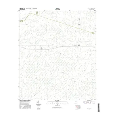
2017 Map of Haylow
USGS Topo · Published 2017About this map
The Georgia lowlands where Echols, Lanier, and Clinch Counties meet are defined by an expansive network of wetlands and small watercourses. This landscape is characterized by numerous distinct "bays"—natural depressions such as Ruddy Bay, Bee Bay, and Boggy Bay—that punctuate the terrain between the slow-moving waters of Cow Cr and Pindar Cr. These features dominate the topography, creating a patchwork of hydrology that has historically dictated the placement of roads and small settlements.
Find a feature on this map
32 named features on this map. Tap any name to fly to it.
Don’t see what you’re looking for? This feature index may not catch every label — zoom into the map to look around manually.
Map Details
Editions of this 2017 Haylow Map
This is the sole edition of this map. No revisions or reprints were ever made.
Other maps of this area

1954 · Valdosta
USGS Topo · 1:250,000

1958 · Valdosta
USGS Topo · 1:250,000

1959 · Valdosta
USGS Topo · 1:250,000

1968 · Naylor
USGS Topo · 1:24,000

1971 · Thelma
USGS Topo · 1:24,000

1971 · Howell
USGS Topo · 1:24,000

1971 · Du Pont
USGS Topo · 1:24,000

1971 · Stockton
USGS Topo · 1:24,000

1971 · Tarver
USGS Topo · 1:24,000
1971 · Pineland
USGS Topo · 1:24,000