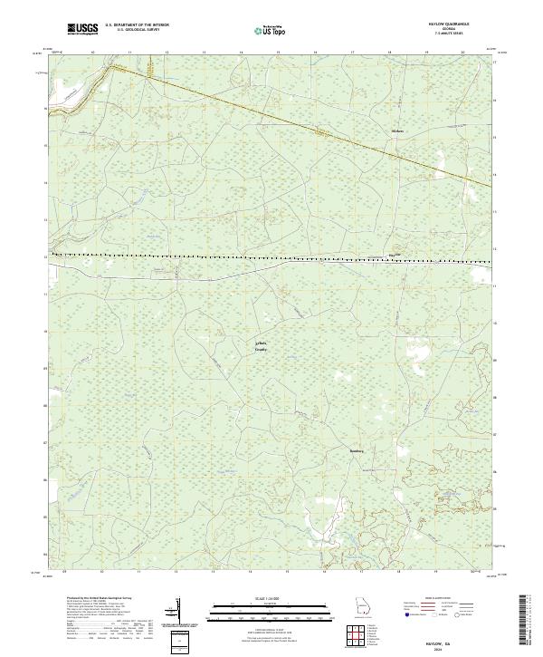
2024 Map of Haylow
USGS Topo · Published 2024About this map
Echols County and the borderlands of Clinch and Lanier counties define this southern Georgia landscape, where the settlements of Withers, Haylow, and Bamburg are connected by a network of local roads including Bamburg Rd and Raulerson Rd. The area is characterized by numerous swampy depressions locally identified as bays, which dominate the topography and hydrology. Prominent examples such as Ruddy Bay, Bee Bay, and Boggy Bay indicate a low-lying, water-saturated environment where drainage is managed by small watercourses like Pindar Creek and Bill Branch. The presence of these named bays alongside features like Sand Hill Bay and Simmons Bay suggests a landscape largely shaped by traditional land use and environmental management in a region where the timber and agricultural industries have long coexisted with the natural wetlands of the coastal plain.
Find a feature on this map
39 named features on this map. Tap any name to fly to it.
Don’t see what you’re looking for? This feature index may not catch every label — zoom into the map to look around manually.
Map Details
Editions of this 2024 Haylow Map
This is the sole edition of this map. No revisions or reprints were ever made.
Other maps of this area

1954 · Valdosta
USGS Topo · 1:250,000

1958 · Valdosta
USGS Topo · 1:250,000

1959 · Valdosta
USGS Topo · 1:250,000

1968 · Naylor
USGS Topo · 1:24,000

1971 · Thelma
USGS Topo · 1:24,000

1971 · Howell
USGS Topo · 1:24,000

1971 · Du Pont
USGS Topo · 1:24,000

1971 · Stockton
USGS Topo · 1:24,000

1971 · Tarver
USGS Topo · 1:24,000
1971 · Pineland
USGS Topo · 1:24,000