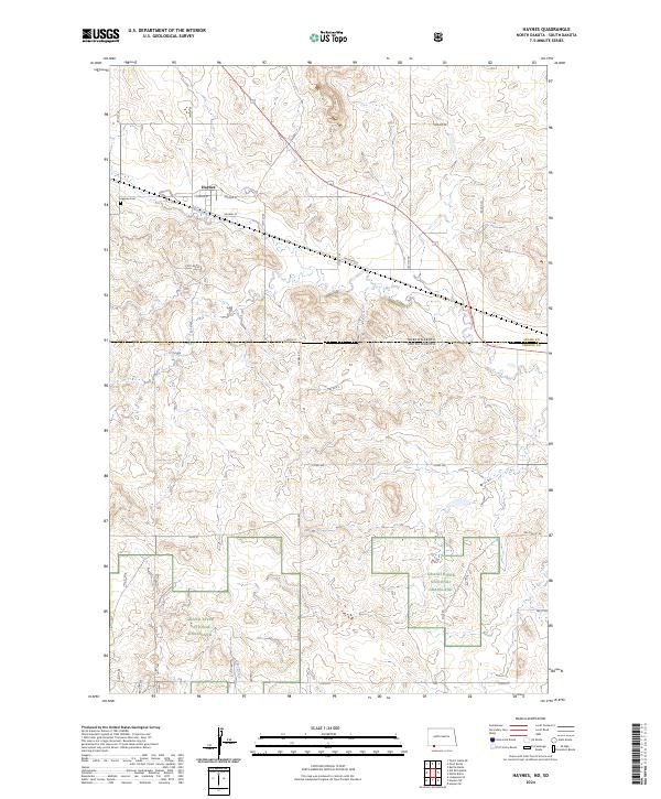
2024 Map of Haynes
USGS Topo · Published 2024About this map
Haynes serves as the central settlement on this modern quadrangle, situated at the intersection of a established grid system and the historical influence of Railway St. The landscape transitions from the residential and agricultural layout of the town—documented by local landmarks like Haynes Cem and Conklin St—into the protected reaches of the Grand River National Grassland. Drainage patterns in this high plains region are defined by Flat Creek in the north and Giles Creek to the south, cutting through the section-line roads that dominate the territory. The survey clearly delineates the border between Adams Co, North Dakota, and Perkins County, South Dakota, illustrating how the legal township and range lines like t129n r94w continue to govern the organization of this ranching and grassland country.
Find a feature on this map
34 named features on this map. Tap any name to fly to it.
Don’t see what you’re looking for? This feature index may not catch every label — zoom into the map to look around manually.
Map Details
Editions of this 2024 Haynes Map
This is the sole edition of this map. No revisions or reprints were ever made.
Other maps of this area

1953 · Dickinson
USGS Topo · 1:250,000

1954 · Lemmon
USGS Topo · 1:250,000

1957 · Dickinson
USGS Topo · 1:250,000

1957 · Lemmon
USGS Topo · 1:250,000

1974 · White Butte
USGS Topo · 1:24,000

1974 · Kid Rich Butte
USGS Topo · 1:24,000

1974 · Haynes
USGS Topo · 1:24,000

1980 · Mott
USGS Topo · 1:100,000

1983 · Lodgepole SE
USGS Topo · 1:24,000

1983 · Haynes SE
USGS Topo · 1:24,000