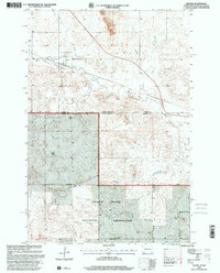
1998 Map of Haynes
USGS Topo · Published 2001About this map
The town of Haynes serves as the focal point for this rural landscape on the North Dakota-South Dakota border, where a network of family ranches and public lands meet the high plains. Extensive ranching operations are documented across the terrain, including the N Wolff Ranch, A Wolff Ranch, and Foss Bros Ranch. The area south of the Seventh Standard Parallel North transitions into the Grand River National Grassland, a managed prairie environment punctuated by cattle tanks and seasonal wells. Cultural markers such as the Haynes Cem and a local Townhall anchor the small community, while economic activity is indicated by a Strip Mine and Gravel Pit located to the north. The winding path of Flat Creek cuts through the buttes, including White Butte and Castle Butte, illustrating the drainage patterns that define this section of the Great Plains.
Find a feature on this map
21 named features on this map. Tap any name to fly to it.
Don’t see what you’re looking for? This feature index may not catch every label — zoom into the map to look around manually.
Map Details
Editions of this 1998 Haynes Map
This is the sole edition of this map. No revisions or reprints were ever made.
Other maps of this area

1953 · Dickinson
USGS Topo · 1:250,000

1954 · Lemmon
USGS Topo · 1:250,000

1957 · Dickinson
USGS Topo · 1:250,000

1957 · Lemmon
USGS Topo · 1:250,000

1974 · White Butte
USGS Topo · 1:24,000

1974 · Kid Rich Butte
USGS Topo · 1:24,000

1974 · Haynes
USGS Topo · 1:24,000

1980 · Mott
USGS Topo · 1:100,000

1983 · Lodgepole SE
USGS Topo · 1:24,000

1983 · Haynes SE
USGS Topo · 1:24,000