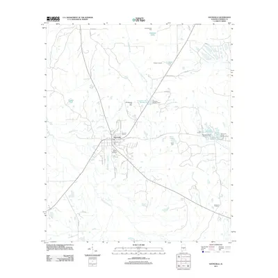
2011 Map of Hayneville
USGS Topo · Published 2011About this map
Hayneville serves as the central hub of this Lowndes County landscape, situated at the convergence of several regional routes. The town's civic core is anchored by the Hayneville Post Office, while its long history is documented through numerous family and community burial grounds, including the Hayneville Cemetery and Mushat Gilchrist Cemetery. The surrounding countryside is defined by a dense network of water features and agricultural infrastructure, notably the winding path of Tallawassee Creek and several small reservoirs such as Crenshaw Pond and Grant Lake. These water bodies are often managed by specific structures like the Grant Dam and Neil Robinson Dam, reflecting a local economy tied to water management and land use. To the south, the terrain is shaped by Fort Deposit Creek, while smaller tributaries like Rambo Branch and North Prong Steep Creek carve through the coastal plain, marking the boundaries of rural holdings and long-established homesteads.
Find a feature on this map
51 named features on this map. Tap any name to fly to it.
Don’t see what you’re looking for? This feature index may not catch every label — zoom into the map to look around manually.
Map Details
Editions of this 2011 Hayneville Map
This is the sole edition of this map. No revisions or reprints were ever made.
Other maps of this area

1927 · Montgomery
USGS Topo · 1:48,000

1930 · Montgomery
USGS Topo · 1:62,500

1953 · Montgomery
USGS Topo · 1:250,000

1956 · Montgomery
USGS Topo · 1:250,000

1957 · Montgomery
USGS Topo · 1:250,000

1957 · Letohatchee
USGS Topo · 1:62,500

1957 · Autaugaville
USGS Topo · 1:62,500

1958 · Montgomery
USGS Topo · 1:62,500

1975 · Autaugaville SW
USGS Topo · 1:24,000

1975 · Autaugaville SE
USGS Topo · 1:24,000