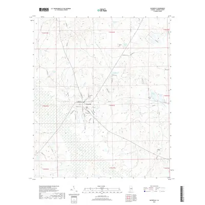
2018 Map of Hayneville
USGS Topo · Published 2018About this map
Hayneville serves as the central hub of this Lowndes County landscape, situated at the intersection of numerous local routes such as W Tuskeena St and S Commerce St. The town plan is anchored by historical family and community markers, including the Hayneville Cem and the nearby Mushat Gilchrist Cem. Outside the residential center, the terrain is defined by a dense network of waterways and ponds, notably Fort Deposit Cr in the south and the meandering path of Tallawassee Cr to the north.
Find a feature on this map
68 named features on this map. Tap any name to fly to it.
Don’t see what you’re looking for? This feature index may not catch every label — zoom into the map to look around manually.
Map Details
Editions of this 2018 Hayneville Map
This is the sole edition of this map. No revisions or reprints were ever made.
Other maps of this area

1927 · Montgomery
USGS Topo · 1:48,000

1930 · Montgomery
USGS Topo · 1:62,500

1953 · Montgomery
USGS Topo · 1:250,000

1956 · Montgomery
USGS Topo · 1:250,000

1957 · Montgomery
USGS Topo · 1:250,000

1957 · Letohatchee
USGS Topo · 1:62,500

1957 · Autaugaville
USGS Topo · 1:62,500

1958 · Montgomery
USGS Topo · 1:62,500

1975 · Autaugaville SW
USGS Topo · 1:24,000

1975 · Autaugaville SE
USGS Topo · 1:24,000