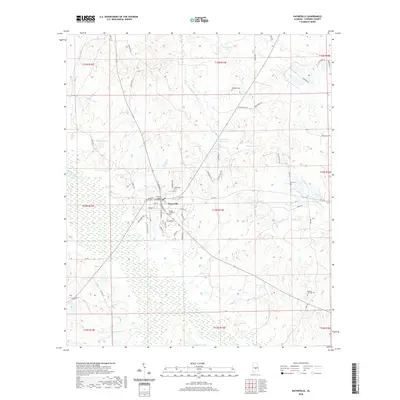
2020 Map of Hayneville
USGS Topo · Published 2020About this map
The Lowndes County Courthouse stands at the center of Hayneville, serving as the primary anchor for this central Alabama landscape. This 2020 edition provides a modern view of the town's grid, featuring streets named for local families and flora such as Tyson Rd, Caffey Dr, and Pecan St. The surrounding countryside is defined by its water systems and family-owned lands, with numerous small lakes and ponds including Robinsons Lake, Grant Lake, and Crenshaws Pond Number Two.
Find a feature on this map
65 named features on this map. Tap any name to fly to it.
Don’t see what you’re looking for? This feature index may not catch every label — zoom into the map to look around manually.
Map Details
Editions of this 2020 Hayneville Map
This is the sole edition of this map. No revisions or reprints were ever made.
Other maps of this area

1927 · Montgomery
USGS Topo · 1:48,000

1930 · Montgomery
USGS Topo · 1:62,500

1953 · Montgomery
USGS Topo · 1:250,000

1956 · Montgomery
USGS Topo · 1:250,000

1957 · Montgomery
USGS Topo · 1:250,000

1957 · Letohatchee
USGS Topo · 1:62,500

1957 · Autaugaville
USGS Topo · 1:62,500

1958 · Montgomery
USGS Topo · 1:62,500

1975 · Autaugaville SW
USGS Topo · 1:24,000

1975 · Autaugaville SE
USGS Topo · 1:24,000