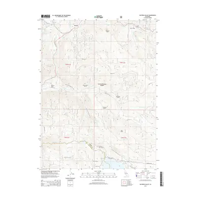
2015 Map of Haypress Valley
USGS Topo · Published 2015About this map
Bassetts serves as a small gateway to the high elevations of the Tahoe National Forest, where the headwaters of the N Yuba River and Middle Yuba River carve through the Sierra Nevada landscape. The area is defined by its deep canyons and high meadows, including Thompson Meadows and the alpine expanse of Lincoln Valley. Significant water management and transportation infrastructure are visible, notably the Milton-Bowman Tunnel which underscores the region's history of hydraulic engineering. The Pacific Crest National Scenic Trail winds through the center of this map, crossing the Great Eastern Ravine and passing near the quiet settlement of Haypress Valley. For those researching regional history, the map provides precise locations for early mountain routes such as Henness Pass Rd and Salmon Creek Rd.
Find a feature on this map
48 named features on this map. Tap any name to fly to it.
Don’t see what you’re looking for? This feature index may not catch every label — zoom into the map to look around manually.
Map Details
Editions of this 2015 Haypress Valley Map
This is the sole edition of this map. No revisions or reprints were ever made.
Other maps of this area

1890 · Sierraville
USGS Topo · 1:125,000

1891 · Downieville
USGS Topo · 1:125,000

1891 · Colfax
USGS Topo · 1:125,000

1891 · Truckee
USGS Topo · 1:125,000

1892 · Sierraville
USGS Topo · 1:125,000

1892 · Colfax
USGS Topo · 1:125,000

1893 · Truckee
USGS Topo · 1:125,000

1893 · Downieville
USGS Topo · 1:125,000

1894 · Colfax
USGS Topo · 1:125,000

1894 · Sierraville
USGS Topo · 1:125,000