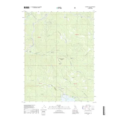
2018 Map of Haypress Valley
USGS Topo · Published 2018About this map
Bassetts serves as a key high-country waypoint within the Tahoe National Forest, where the N Yuba River and its numerous tributaries like Salmon Cr and Sardine Cr carve through the Sierra Nevada landscape. The 2018 survey reveals a network of high-elevation meadows and valleys, including Lincoln Valley, Haypress Valley, and Bear Valley, many connected by the historic Henness Pass Rd. A significant engineering element is visible in the south, where the Milton-Bowman Tunnel links the Milton Reservoir to broader water management systems. Recreational corridors are prominent throughout, highlighted by the PCT - Pacific Crest trail as it winds past landmarks such as Thompson Meadows and Big Springs. From the peak of Deadman Peak down to the basins of Jackson Meadows Reservoir, the map documents a terrain defined by its complex hydrology and the legacy of mountain transit routes.
Find a feature on this map
58 named features on this map. Tap any name to fly to it.
Don’t see what you’re looking for? This feature index may not catch every label — zoom into the map to look around manually.
Map Details
Editions of this 2018 Haypress Valley Map
This is the sole edition of this map. No revisions or reprints were ever made.
Other maps of this area

1890 · Sierraville
USGS Topo · 1:125,000

1891 · Downieville
USGS Topo · 1:125,000

1891 · Colfax
USGS Topo · 1:125,000

1891 · Truckee
USGS Topo · 1:125,000

1892 · Sierraville
USGS Topo · 1:125,000

1892 · Colfax
USGS Topo · 1:125,000

1893 · Truckee
USGS Topo · 1:125,000

1893 · Downieville
USGS Topo · 1:125,000

1894 · Colfax
USGS Topo · 1:125,000

1894 · Sierraville
USGS Topo · 1:125,000