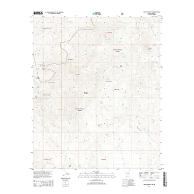
2014 Map of Haystack Butte
USGS Topo · Published 2014About this map
Tonto National Forest land defines this reach of Gila County, where the Salt River carves deep through the Salt River Canyon. The drainage network is complex, characterized by steep descents such as Jump-Off Canyon and the winding Hess Canyon that eventually feed the main river. Water sources are vital in this arid terrain, marked by scattered tanks and springs like Butte Tank, Yellowjacket Spring, and Yankee Joe Seep. Dominant elevations like Haystack Butte and the Blackjack Mountains provide significant vertical relief against the canyon floor, where white-water features like The Maze Rapid illustrate the river's force. The presence of Haystack Butte Rd provides one of the few named access points into this labyrinthine landscape of canyons and mesas.
Find a feature on this map
58 named features on this map. Tap any name to fly to it.
Don’t see what you’re looking for? This feature index may not catch every label — zoom into the map to look around manually.
Map Details
Editions of this 2014 Haystack Butte Map
This is the sole edition of this map. No revisions or reprints were ever made.
Other maps of this area

1922 · Chrysotile
USGS Topo · 1:125,000

1946 · Blue House Mtn
USGS Topo · 1:62,500

1949 · McFadden Peak
USGS Topo · 1:62,500

1949 · Rockinstraw Mtn
USGS Topo · 1:62,500

1950 · Rockinstraw Mtn
USGS Topo · 1:62,500

1950 · McFadden Peak
USGS Topo · 1:62,500

1951 · Blue House Mtn
USGS Topo · 1:62,500

1954 · Mesa
USGS Topo · 1:250,000

1957 · Mesa
USGS Topo · 1:250,000

1958 · Mesa
USGS Topo · 1:250,000