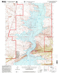
1996 Map of Haystack Buttes South
USGS Topo · Published 1999About this map
The Green River carves a deep path through southern Wyoming, its waters held by the Flaming Gorge Reservoir as it passes through the Ashley National Forest. This 1996 revision shows the landscape after the completion of the dam, with the reservoir reaching an elevation of 6,040 feet. The terrain is marked by prominent landforms such as the Haystack Buttes and the steep walls of The Glades. Infrastructure supporting the region's utilities and management is visible, including a Gas Pipeline, a Cathodic Protection Station, and a Pumping Station. The map also captures the complex hydrology of the canyon country, where drainages like Twin Buttes Draw and Wildhorse Draw feed into the reservoir within the Flaming Gorge National Recreation Area.
Find a feature on this map
17 named features on this map. Tap any name to fly to it.
Don’t see what you’re looking for? This feature index may not catch every label — zoom into the map to look around manually.
Map Details
Editions of this 1996 Haystack Buttes South Map
This is the sole edition of this map. No revisions or reprints were ever made.
Other maps of this area

1885 · Ashley
USGS Topo · 1:250,000

1906 · Marsh Peak
USGS Topo · 1:125,000

1908 · Marsh Peak
USGS Topo · 1:125,000

1952 · Dutch John Mtn
USGS Topo · 1:24,000

1952 · Flaming Gorge
USGS Topo · 1:24,000

1954 · Vernal
USGS Topo · 1:250,000

1954 · Rock Springs
USGS Topo · 1:250,000

1957 · Currant Creek Ranch
USGS Topo · 1:62,500

1958 · Vernal
USGS Topo · 1:250,000

1958 · Rock Springs
USGS Topo · 1:250,000