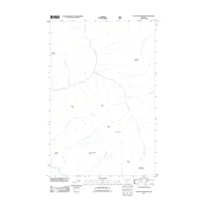
2011 Map of Haystack Mountain
USGS Topo · Published 2011About this map
Haystack Mountain rises above a landscape defined by the convergence of mountain ridges and a complex network of waterways in Flathead County. The high peaks of the Lewis and Clark Range and the Flathead Alps dominate the southeastern quadrant, where the headwaters of the South Fork Flathead River originate. This terrain is marked by sharp topographic transitions, from the sheer heights of Rampart Mountain and Tillson Peak to the descent of the White River.
Find a feature on this map
20 named features on this map. Tap any name to fly to it.
Don’t see what you’re looking for? This feature index may not catch every label — zoom into the map to look around manually.
Map Details
Editions of this 2011 Haystack Mountain Map
This is the sole edition of this map. No revisions or reprints were ever made.
Other maps of this area

1902 · Ovando
USGS Topo · 1:125,000

1905 · Ovando
USGS Topo · 1:125,000

1936 · Silvertip
USGS Topo · 1:96,000

1942 · Silvertip
USGS Topo · 1:125,000

1955 · Choteau
USGS Topo · 1:250,000

1957 · Choteau
USGS Topo · 1:250,000

1958 · Choteau
USGS Topo · 1:250,000

1962 · Choteau
USGS Topo · 1:250,000

1970 · Big Salmon Lake East
USGS Topo · 1:24,000
1970 · Prairie Reef
USGS Topo · 1:24,000