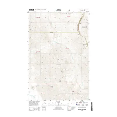
2014 Map of Haystack Mountain
USGS Topo · Published 2014About this map
Big Prairie serves as a remote focal point at the junction of several drainage systems in this 2014 survey of the Lewis and Clark Range. The landscape is dominated by the dramatic uplift of the Chinese Wall and the Flathead Alps, where the Flathead National Forest and Lewis & Clark National Forest meet. This terrain is defined by its complex hydrology, with the White River and South Fork White River carving deep valleys between high summits like Haystack Mtn and Tillson Peak. The map highlights the intersection of Flathead, Powell, and Lewis and Clark counties, marking a high-elevation backcountry where geography dictates the path of travel through White River Pass. Explorers and researchers can trace the course of the South Fork Flathead River and identify localized high-altitude water bodies such as Prisoner Lake.
Find a feature on this map
34 named features on this map. Tap any name to fly to it.
Don’t see what you’re looking for? This feature index may not catch every label — zoom into the map to look around manually.
Map Details
Editions of this 2014 Haystack Mountain Map
This is the sole edition of this map. No revisions or reprints were ever made.
Other maps of this area

1902 · Ovando
USGS Topo · 1:125,000

1905 · Ovando
USGS Topo · 1:125,000

1936 · Silvertip
USGS Topo · 1:96,000

1942 · Silvertip
USGS Topo · 1:125,000

1955 · Choteau
USGS Topo · 1:250,000

1957 · Choteau
USGS Topo · 1:250,000

1958 · Choteau
USGS Topo · 1:250,000

1962 · Choteau
USGS Topo · 1:250,000

1970 · Big Salmon Lake East
USGS Topo · 1:24,000
1970 · Prairie Reef
USGS Topo · 1:24,000