
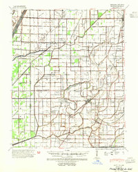
1940 Map of Hayti
USGS Topo · Published 1943About this map
The Missouri Bootheel landscape of Pemiscot County reveals a dense network of agricultural settlements and drainage systems shortly before World War II. The St Louis Southwestern railroad serves as the primary corridor for commerce, linking towns like Hayti and Steele. The map shows an intricate system of laterals and ditches designed to manage the lowland terrain, punctuated by original water features like Clay Root Bayou and the Elk Chute. Historical markers of rural life are exceptionally well-documented, from the County Farm near the northern boundary to numerous combined social centers like Vicksburg Sch & Ch and Samford Sch & Ch. Local genealogists will find significant value in the sheer density of family-named landmarks, including Temples Corner, Holbert Corner, and Acorn Corner, alongside many small burial grounds such as Denton Green Cem and Cagle Cem.
Find a feature on this map
70 named features on this map. Tap any name to fly to it.
Don’t see what you’re looking for? This feature index may not catch every label — zoom into the map to look around manually.
Map Details
Editions of this 1940 Hayti Map
2 editions found
Other maps of this area

1934 · Kennett
USGS Topo · 1:62,500

1939 · Portageville
USGS Topo · 1:62,500

1939 · Hales Point
USGS Topo · 1:62,500

1939 · Caruthersville
USGS Topo · 1:62,500

1939 · Blytheville
USGS Topo · 1:62,500

1940 · Pascola
USGS Topo · 1:62,500

1940 · Kennett
USGS Topo · 1:62,500

1940 · Piggott
USGS Topo · 1:62,500

1941 · Manila
USGS Topo · 1:62,500

1951 · Caruthersville
USGS Topo · 1:62,500