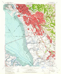
1959 Map of Hayward
USGS Topo · Published 1961About this map
Salt evaporators and tidal mudflats dominate the eastern shoreline of San Francisco Bay in this mid-century survey. The landscape is defined by rapid postwar expansion along the East Bay, where the newly constructed Nimitz Freeway serves as a central spine for growing communities like Hayward, San Leandro, and Castro Valley. Inland, the terrain rises toward Walpert Ridge and the wooded canyons of Anthony Chabot Regional Park, while the coastal plain shows the industrial and transit infrastructure of the era, including the Hetch Hetchy Aqueduct and the Metropolitan Oakland International Airport. Local history is preserved in details like the now-redeveloped Russell City and several smaller landings such as Roberts Landing and Johnson Landing, which once served as vital maritime links before the modernization of the shoreline.
Find a feature on this map
82 named features on this map. Tap any name to fly to it.
Don’t see what you’re looking for? This feature index may not catch every label — zoom into the map to look around manually.
Map Details
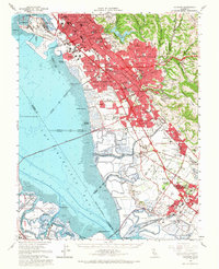
Editions of this 1959 Hayward Map
2 editions found
Other maps of this area

1889 · San Jose
USGS Topo · 1:62,500

1892 · San Mateo
USGS Topo · 1:62,500

1895 · San Francisco
USGS Topo · 1:62,500

1896 · San Mateo
USGS Topo · 1:62,500

1896 · Mt. Diablo
USGS Topo · 1:62,500

1897 · San Jose
USGS Topo · 1:62,500

1897 · Concord
USGS Topo · 1:62,500

1897 · Palo Alto
USGS Topo · 1:62,500

1898 · Mt. Diablo
USGS Topo · 1:62,500

1899 · San Jose
USGS Topo · 1:62,500