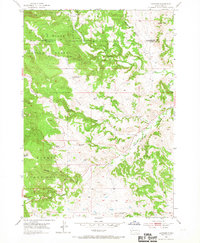
1954 Map of Hayward
USGS Topo · Published 1967About this map
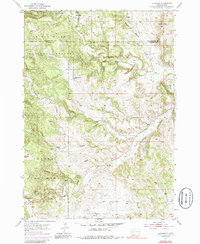
Hayward sits at the junction of Battle Creek and Iron Creek, marking a landscape defined by the mineral and timber resources of the southern Black Hills. In the mid-1950s, this area straddled the boundary of Pennington and Custer counties, showing a transition from the industrial activity at Mine Dumps to the preserved lands of the Black Hills National Forest and Custer State Park. The map reveals a rural network of social and agricultural infrastructure, including the Central Sch and Cobb Sch, alongside smaller landmarks like a Windmill. Waterways such as Grace Coolidge Creek and Spokane Creek carve through the terrain, illustrating the drainage patterns that shaped local travel and early settlement. The presence of a Cem and scattered Mine workings provides specific points of interest for genealogists and industrial historians studying the development of this South Dakota region.
Find a feature on this map
21 named features on this map. Tap any name to fly to it.
Don’t see what you’re looking for? This feature index may not catch every label — zoom into the map to look around manually.
Map Details
Editions of this 1954 Hayward Map
6 editions found
Other maps of this area

1894 · Hermosa
USGS Topo · 1:125,000

1901 · Hermosa
USGS Topo · 1:125,000

1953 · Hermosa NW
USGS Topo · 1:24,000

1953 · Hermosa
USGS Topo · 1:24,000
1954 · Rockerville
USGS Topo · 1:24,000

1954 · Iron Mountain
USGS Topo · 1:24,000
1954 · Mount Rushmore
USGS Topo · 1:24,000

1954 · Hayward
USGS Topo · 1:24,000

1954 · Mount Rushmore
USGS Topo · 1:62,500

1955 · Mt. Coolidge
USGS Topo · 1:24,000