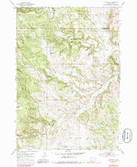
1954 Map of Hayward
USGS Topo · Published 1986About this map
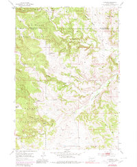
Hayward sits at the intersection of early Black Hills mining and mid-century land conservation. The landscape is defined by the sharp transition between the Black Hills National Forest and Custer State Park, marked by a network of drainage systems including Iron Creek, Deadman Gulch, and Battle Creek. Evidence of the area's industrial past remains visible through Mine Dumps and unnamed Mine sites located near the northern settlements. The presence of Central Sch and the small residential cluster at Round Park reflect the sparse but established community infrastructure in this part of Custer Co and Pennington Co during the 1950s. The terrain rises to prominence at Lakota Peak, overlooking a rugged network of gulches and creeks like Spokane Creek and Whiskey Gulch that have historically shaped access through these hills.
Find a feature on this map
18 named features on this map. Tap any name to fly to it.
Don’t see what you’re looking for? This feature index may not catch every label — zoom into the map to look around manually.
Map Details
Editions of this 1954 Hayward Map
6 editions found
Other maps of this area

1894 · Hermosa
USGS Topo · 1:125,000

1901 · Hermosa
USGS Topo · 1:125,000

1953 · Hermosa NW
USGS Topo · 1:24,000

1953 · Hermosa
USGS Topo · 1:24,000
1954 · Rockerville
USGS Topo · 1:24,000

1954 · Iron Mountain
USGS Topo · 1:24,000
1954 · Mount Rushmore
USGS Topo · 1:24,000

1954 · Hayward
USGS Topo · 1:24,000

1954 · Mount Rushmore
USGS Topo · 1:62,500

1955 · Mt. Coolidge
USGS Topo · 1:24,000