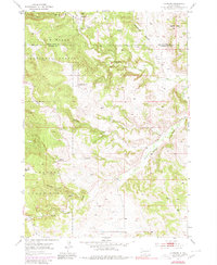
1954 Map of Hayward
USGS Topo · Published 1980About this map
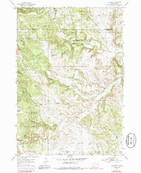
Hayward sits at the northern edge of a landscape defined by deep gulches and significant public lands during the mid-20th century. The settlement, positioned near Battle Creek, is surrounded by evidence of local resource extraction, including Mine Dumps and several unnamed mines scattered through the hills. This area marks the meeting point of the Black Hills National Forest and Custer State Park, where the terrain is carved by complex drainage systems like Deadman Gulch, Bear Gulch, and Whiskey Gulch. To the south, Grace Coolidge Creek winds through the parklands, while Lakota Peak stands as a prominent landmark to the northeast. The presence of the Central Sch indicates a rural community structure persisting in this mountainous region, supported by a network of unimproved roads and light-duty trails that connect these isolated mountain features and waterways.
Find a feature on this map
20 named features on this map. Tap any name to fly to it.
Don’t see what you’re looking for? This feature index may not catch every label — zoom into the map to look around manually.
Map Details
Editions of this 1954 Hayward Map
6 editions found
Other maps of this area

1894 · Hermosa
USGS Topo · 1:125,000

1901 · Hermosa
USGS Topo · 1:125,000

1953 · Hermosa NW
USGS Topo · 1:24,000

1953 · Hermosa
USGS Topo · 1:24,000
1954 · Rockerville
USGS Topo · 1:24,000

1954 · Iron Mountain
USGS Topo · 1:24,000
1954 · Mount Rushmore
USGS Topo · 1:24,000

1954 · Hayward
USGS Topo · 1:24,000

1954 · Mount Rushmore
USGS Topo · 1:62,500

1955 · Mt. Coolidge
USGS Topo · 1:24,000