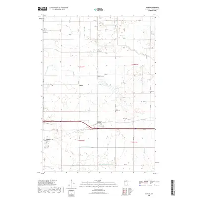
2019 Map of Hayward
USGS Topo · Published 2019About this map
Hayward and its agricultural surroundings in Freeborn County are defined by a complex network of drainage canals and small watercourses. The landscape is structured by significant engineering projects like County Ditch Number Twelve and County Ditch Number Fortyseven, which manage the low-lying terrain near Hollandale Junction. These ditches, along with natural features like Turtle Cr and Beer Cr, underscore the area's transition from wetlands to productive farmland.
Find a feature on this map
67 named features on this map. Tap any name to fly to it.
Don’t see what you’re looking for? This feature index may not catch every label — zoom into the map to look around manually.
Map Details
Editions of this 2019 Hayward Map
This is the sole edition of this map. No revisions or reprints were ever made.
Other maps of this area

1954 · Albert Lea
USGS Topo · 1:62,500

1954 · Hayward
USGS Topo · 1:62,500

1954 · Mason City
USGS Topo · 1:250,000

1957 · Mason City
USGS Topo · 1:250,000

1958 · Mason City
USGS Topo · 1:250,000

1967 · Blooming Prairie
USGS Topo · 1:24,000

1967 · Hollandale
USGS Topo · 1:24,000

1967 · Ellendale
USGS Topo · 1:24,000

1982 · Hayward
USGS Topo · 1:24,000
1982 · London
USGS Topo · 1:24,000