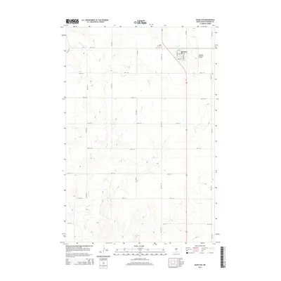
2014 Map of Hazelton
USGS Topo · Published 2014About this map
Hazelton serves as the primary hub in this portion of Emmons County, situated along a north-south highway corridor. The town's grid is clearly defined by streets such as Main St, Hazel Ave, and Claremont Ave, while the surrounding landscape is dominated by a systematic section-line road network. To the north, Saint Paul Cem provides a point of genealogical interest for those tracing local family histories. The drainage patterns of the prairie are marked by the intermittent paths of Hawk Cr and Sand Cr, which wind through the agricultural terrain. On the eastern edge of the community, the Hazelton Municipal Airport underscores the importance of regional connectivity for this rural North Dakota settlement.
Find a feature on this map
25 named features on this map. Tap any name to fly to it.
Don’t see what you’re looking for? This feature index may not catch every label — zoom into the map to look around manually.
Map Details
Editions of this 2014 Hazelton Map
This is the sole edition of this map. No revisions or reprints were ever made.
Other maps of this area

1954 · Bismarck
USGS Topo · 1:250,000

1958 · Bismarck
USGS Topo · 1:250,000

1971 · Moffit SW
USGS Topo · 1:24,000

1971 · Hazelton
USGS Topo · 1:24,000

1971 · Moffit SE
USGS Topo · 1:24,000

1971 · Hazelton SW
USGS Topo · 1:24,000
1971 · Hazelton NW
USGS Topo · 1:24,000

1971 · Temvik
USGS Topo · 1:24,000

1975 · Dana
USGS Topo · 1:24,000

1975 · Appert Lake
USGS Topo · 1:24,000