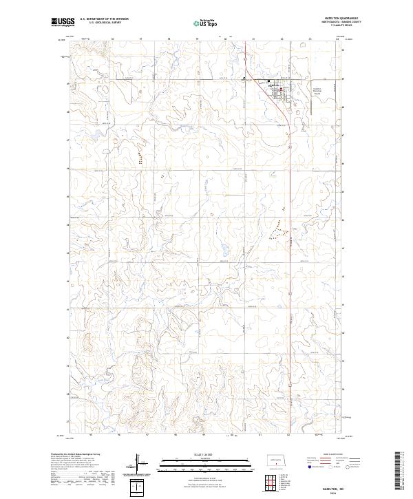
2024 Map of Hazelton
USGS Topo · Published 2024About this map
Hazelton serves as the primary hub of this Emmons County landscape, situated where the high plains meet a network of seasonal drainages. The town's grid is bordered by the Hazelton Municipal Airport to the east and the Hazelton Cem and Saint Paul Cem to the northwest, providing clear landmarks for local history and genealogical research. The surrounding countryside is defined by the headwaters of Hawk Creek and Sand Creek, which carve gentle coulees through the agricultural sections. In the eastern reaches of the survey, the Appert Lake National Wildlife Refuge preserves a critical wetland habitat, illustrating the region's importance as a sanctuary for migratory birds within the Missouri River drainage basin.
Find a feature on this map
20 named features on this map. Tap any name to fly to it.
Don’t see what you’re looking for? This feature index may not catch every label — zoom into the map to look around manually.
Map Details
Editions of this 2024 Hazelton Map
This is the sole edition of this map. No revisions or reprints were ever made.
Other maps of this area

1954 · Bismarck
USGS Topo · 1:250,000

1958 · Bismarck
USGS Topo · 1:250,000

1971 · Moffit SW
USGS Topo · 1:24,000

1971 · Hazelton
USGS Topo · 1:24,000

1971 · Moffit SE
USGS Topo · 1:24,000

1971 · Hazelton SW
USGS Topo · 1:24,000
1971 · Hazelton NW
USGS Topo · 1:24,000

1971 · Temvik
USGS Topo · 1:24,000

1975 · Dana
USGS Topo · 1:24,000

1975 · Appert Lake
USGS Topo · 1:24,000