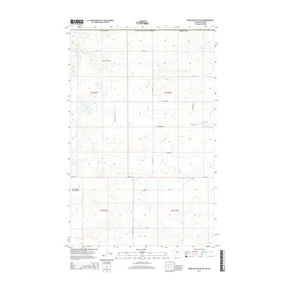
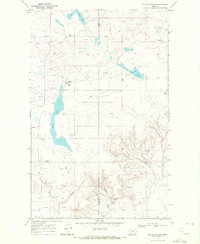
2014 Map of Headlight Butte NE
USGS Topo · Published 2014About this map
Lukins Lake and the intermittent flow of the Red River characterize this stretch of the northern Montana plains. The landscape is defined by the Public Land Survey System, with township and range lines like t37n r6w organizing a grid of rural roads and remote ranch access points. Named drainages such as Pearsons Coulee and East Fork Big Rock Coulee indicate the subtle shifts in elevation across this high-country terrain. A network of family-named thoroughfares, including Fred Berkram Rd and Gary Berkram Rd, reflects the agricultural heritage and local landownership in Glacier County near the international boundary. This modern survey maps the enduring isolation of the region, where gravel routes like Losing Rd and Santa Rita N connect widely dispersed homesteads across the open prairies.
Find a feature on this map
21 named features on this map. Tap any name to fly to it.
Don’t see what you’re looking for? This feature index may not catch every label — zoom into the map to look around manually.
Map Details
Editions of this 2014 Headlight Butte NE Map
This is the sole edition of this map. No revisions or reprints were ever made.
Other maps of this area

1909 · Cut Bank
USGS Topo · 1:125,000

1912 · Cut Bank
USGS Topo · 1:125,000

1960 · Cut Bank
USGS Topo · 1:250,000

1963 · Cut Bank
USGS Topo · 1:250,000

1964 · Cut Bank
USGS Topo · 1:250,000

1968 · Headlight Butte NE
USGS Topo · 1:24,000
1968 · Dead Indian Spring
USGS Topo · 1:24,000
1968 · Fitzpatrick Lake
USGS Topo · 1:24,000
1968 · Headlight Butte NW
USGS Topo · 1:24,000
1968 · Glacier Colony
USGS Topo · 1:24,000