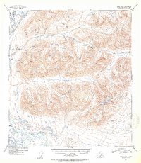
1952 Map of Healy A-1
USGS Topo · Published 1953About this map
The Denali settlement and its nearby Airstrip serve as the primary human footprint in this high-altitude landscape of the early 1950s. Located at the confluence where the West Fork Susitna River feeds into the glacial braided plains of the Susitna River, the area is defined by sharp topographic relief and a network of mining-adjacent drainages. Prospecting history is etched into the terrain with names like Gold Hill, Lucky Gulch, and Valdez Creek. The map documents a period of remote wilderness access, where travel followed natural corridors such as Windy Creek and Pass Creek. To the east, higher elevations around VABM Gate 6017 overlook a series of alpine waters including Roosevelt Lake and Tenas Lake. This survey provides a precise view of the central Alaskan interior before modern development, capturing the essential relationship between the river system and the high mountain passes.
Find a feature on this map
29 named features on this map. Tap any name to fly to it.
Don’t see what you’re looking for? This feature index may not catch every label — zoom into the map to look around manually.
Map Details
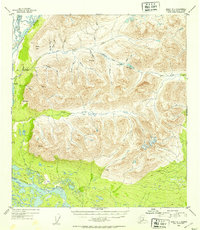
Editions of this 1952 Healy A-1 Map
3 editions found
Other maps of this area

1949 · Healy B-2
USGS Topo · 1:63,360

1949 · Healy A-1
USGS Topo · 1:63,360

1950 · Talkeetna Mountains
USGS Topo · 1:250,000

1950 · Mount Hayes
USGS Topo · 1:250,000

1950 · Healy B-1
USGS Topo · 1:63,360

1950 · Mount Hayes A-6
USGS Topo · 1:63,360

1951 · Healy
USGS Topo · 1:250,000

1951 · Gulkana
USGS Topo · 1:250,000

1951 · Mount Hayes
USGS Topo · 1:250,000

1951 · Gulkana D-6
USGS Topo · 1:63,360