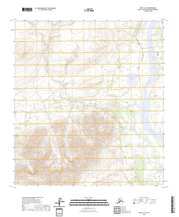
2024 Map of Healy A-2 SE
USGS Topo · Published 2024About this map
Denali Highway 8 cuts across the northeastern corner of this interior Alaska terrain, providing a rare point of access to a landscape defined by high-elevation drainage systems. The wide Susitna River dominates the eastern edge of the map, carving a broad valley floor that collects waters from Windy Creek and Butte Creek. This area is characterized by an extensive network of specialized routes, including the 80.7 Mile South Trl and the Wickersham Creek Trl, which navigate the complex topography surrounding Wickersham Creek. The presence of Snodgrass Lake and various trail segments like the Susitna South Trl and Butte Creek Trl suggests a region utilized for seasonal transit and backcountry travel, where the natural watercourses dictate the paths of least resistance through the Matanuska-Susitna Borough.
Find a feature on this map
14 named features on this map. Tap any name to fly to it.
Don’t see what you’re looking for? This feature index may not catch every label — zoom into the map to look around manually.
Map Details
Editions of this 2024 Healy A-2 SE Map
This is the sole edition of this map. No revisions or reprints were ever made.
Other maps of this area

1949 · Healy A-1
USGS Topo · 1:63,360

1950 · Talkeetna Mountains
USGS Topo · 1:250,000

1951 · Healy
USGS Topo · 1:250,000

1951 · Talkeetna Mountains D-2
USGS Topo · 1:63,360

1951 · Talkeetna Mountains D-1
USGS Topo · 1:63,360

1951 · Healy A-2
USGS Topo · 1:63,360
1952 · Talkeetna Mountains D-1
USGS Topo · 1:63,360
1952 · Healy A-1
USGS Topo · 1:63,360

1952 · Healy A-2
USGS Topo · 1:63,360
1952 · Talkeetna Mountains D-2
USGS Topo · 1:63,360