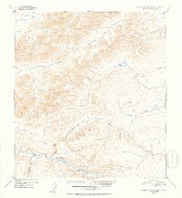
1952 Map of Talkeetna Mountains D-2
USGS Topo · Published 1953About this map
The Susitna River carves a deep valley through this interior Alaskan wilderness, as documented during the early 1950s. The landscape is defined by high-elevation triangulation stations such as VABM 5506 Watana, VABM 4724 Brown, and VABM 3693 Jay, which provided the essential control points for the U.S. Geological Survey's photogrammetric mapping. Evidence of human presence is extremely sparse, limited to a single Cabin situated near the confluence of Kosina Creek and the main river. Numerous tributaries, including Watana Creek, Jay Creek, and Coal Creek, drain the high plateaus and narrow canyons, illustrating a drainage system untouched by development. The lack of roads or established trails highlights the area's isolation during this post-war period of aerial survey.
Find a feature on this map
9 named features on this map. Tap any name to fly to it.
Don’t see what you’re looking for? This feature index may not catch every label — zoom into the map to look around manually.
Map Details
Editions of this 1952 Talkeetna Mountains D-2 Map
2 editions found
Other maps of this area

1949 · Healy A-1
USGS Topo · 1:63,360

1950 · Talkeetna Mountains
USGS Topo · 1:250,000

1950 · Healy A-3
USGS Topo · 1:63,360

1951 · Healy
USGS Topo · 1:250,000

1951 · Talkeetna Mountains C-2
USGS Topo · 1:63,360

1951 · Talkeetna Mountains D-2
USGS Topo · 1:63,360

1951 · Talkeetna Mountains C-1
USGS Topo · 1:63,360

1951 · Talkeetna Mountains D-1
USGS Topo · 1:63,360

1951 · Talkeetna Mountains D-3
USGS Topo · 1:63,360

1951 · Talkeetna Mountains C-3
USGS Topo · 1:63,360