
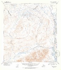
1952 Map of Healy A-2
USGS Topo · Published 1953About this map
The Susitna River carves a dominant path through this portion of the Talkeetna Mountains, marking a vital hydrological corridor for the region during the early 1950s. The landscape is defined by its significant relief, notably at high-elevation survey markers like VABM 6187 Watana and VABM 5187 Native. These triangulation points, alongside VABM 5602 Way, reveal the intensive surveying effort required to map this interior wilderness shortly after the war. A solitary Sled Road in the northern reach provides a rare indication of human transit through the brush and hills, likely used for winter logistics between drainages.
Find a feature on this map
14 named features on this map. Tap any name to fly to it.
Don’t see what you’re looking for? This feature index may not catch every label — zoom into the map to look around manually.
Map Details
Editions of this 1952 Healy A-2 Map
2 editions found
Other maps of this area

1949 · Healy B-2
USGS Topo · 1:63,360

1949 · Healy A-1
USGS Topo · 1:63,360

1950 · Talkeetna Mountains
USGS Topo · 1:250,000

1950 · Healy A-3
USGS Topo · 1:63,360

1950 · Healy B-3
USGS Topo · 1:63,360

1950 · Healy B-1
USGS Topo · 1:63,360

1951 · Healy
USGS Topo · 1:250,000

1951 · Talkeetna Mountains D-2
USGS Topo · 1:63,360

1951 · Talkeetna Mountains D-1
USGS Topo · 1:63,360

1951 · Talkeetna Mountains D-3
USGS Topo · 1:63,360