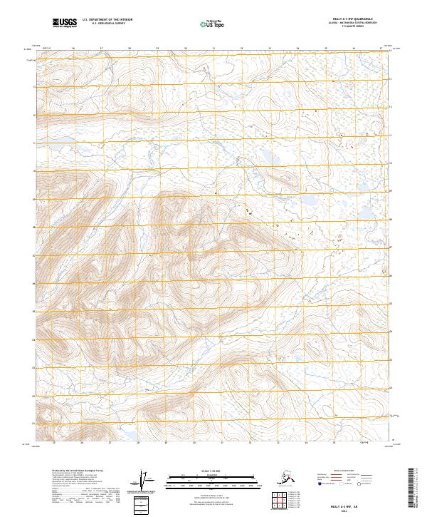
2024 Map of Healy A-3 NW
USGS Topo · Published 2024About this map
Brushkana Creek and its tributary Meadow Creek wind through the interior wilderness of the Matanuska-Susitna Borough in this 2024 Alaska topographic survey. The landscape is defined by the Public Land Survey System grid across several townships, including t19s r4w and t20s r5w, which orient the high-altitude drainage basins and expansive wetlands of this subarctic environment. The absence of roads or permanent settlements within these boundaries underscores the preservation of the natural hydrology and topographical contours, making this an essential record of the contemporary Alaskan backcountry for conservationists and wilderness researchers.
Find a feature on this map
8 named features on this map. Tap any name to fly to it.
Don’t see what you’re looking for? This feature index may not catch every label — zoom into the map to look around manually.
Map Details
Editions of this 2024 Healy A-3 NW Map
This is the sole edition of this map. No revisions or reprints were ever made.
Other maps of this area

1949 · Healy B-4
USGS Topo · 1:63,360

1950 · Healy A-3
USGS Topo · 1:63,360

1950 · Healy B-3
USGS Topo · 1:63,360

1950 · Healy A-4
USGS Topo · 1:63,360

1951 · Healy
USGS Topo · 1:250,000

1951 · Healy B-4
USGS Topo · 1:63,360

1952 · Healy A-4
USGS Topo · 1:63,360
1952 · Healy A-3
USGS Topo · 1:63,360
1952 · Healy B-3
USGS Topo · 1:63,360

1956 · Healy
USGS Topo · 1:250,000