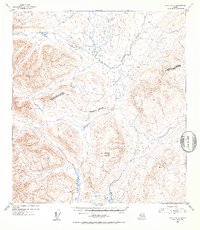
1952 Map of Healy A-3
USGS Topo · Published 1953About this map
Deadman Mountain rises as the central topographical anchor for this high-altitude interior region, which was mapped from 1949 aerial photography. The terrain is defined by a significant drainage network where Brushkana Creek and Deadman Creek carve through the landscape. This 1952 survey provides a clear view of the Fourth Judicial Division Third Judicial Division approximate boundary, which bisects the quadrangle horizontally. The presence of Deadman Lake and Big Lake in the southern reaches, alongside the marshes of Meadow Creek, indicates a complex watershed in this portion of the Alaska Range. The map illustrates a transitional subarctic environment just before mid-century, documented by the U.S. Geological Survey using multiplex methods to translate aerial photography into precise contour data.
Find a feature on this map
8 named features on this map. Tap any name to fly to it.
Don’t see what you’re looking for? This feature index may not catch every label — zoom into the map to look around manually.
Map Details
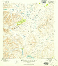
Editions of this 1952 Healy A-3 Map
2 editions found
Other maps of this area

1949 · Healy B-4
USGS Topo · 1:63,360

1949 · Healy B-2
USGS Topo · 1:63,360

1950 · Talkeetna Mountains
USGS Topo · 1:250,000

1950 · Healy A-3
USGS Topo · 1:63,360

1950 · Healy B-3
USGS Topo · 1:63,360

1950 · Healy A-4
USGS Topo · 1:63,360

1951 · Healy
USGS Topo · 1:250,000

1951 · Healy B-4
USGS Topo · 1:63,360

1951 · Talkeetna Mountains D-2
USGS Topo · 1:63,360

1951 · Talkeetna Mountains D-3
USGS Topo · 1:63,360