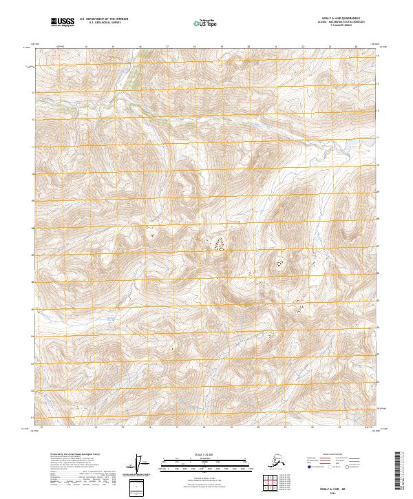
2024 Map of Healy A-4 NE
USGS Topo · Published 2024About this map
Jack River flows through this high-altitude landscape in the Matanuska-Susitna Borough, where steep drainage systems define the territory south of the Alaska Range. The 2024 survey documents a primitive wilderness environment, where the confluence of major waterways like Soule Creek and the headwaters of Tsusena Creek provide the primary geographical markers across several townships, including t19s r6w and t20s r5w. This area is characterized by intense topographic relief and a lack of modern road infrastructure, reflecting the enduring remote character of the Alaskan interior. Local historians and researchers can trace the natural corridors that have historically dictated movement through these mountain passes and valleys.
Find a feature on this map
9 named features on this map. Tap any name to fly to it.
Don’t see what you’re looking for? This feature index may not catch every label — zoom into the map to look around manually.
Map Details
Editions of this 2024 Healy A-4 NE Map
This is the sole edition of this map. No revisions or reprints were ever made.
Other maps of this area

1949 · Healy B-4
USGS Topo · 1:63,360

1950 · Healy A-3
USGS Topo · 1:63,360

1950 · Healy B-3
USGS Topo · 1:63,360

1950 · Healy A-4
USGS Topo · 1:63,360

1951 · Healy
USGS Topo · 1:250,000

1951 · Healy B-4
USGS Topo · 1:63,360

1952 · Healy A-4
USGS Topo · 1:63,360
1952 · Healy A-3
USGS Topo · 1:63,360
1952 · Healy B-3
USGS Topo · 1:63,360

1956 · Healy
USGS Topo · 1:250,000