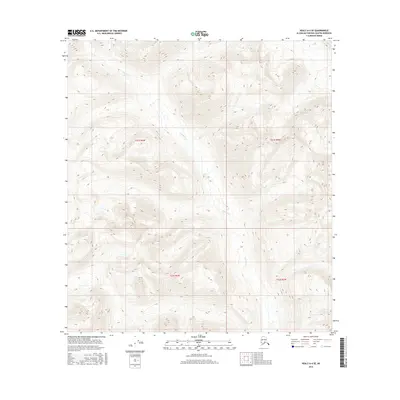
2016 Map of Healy A-4 SE
USGS Topo · Published 2016About this map
Tsusena Cr winds through this high-elevation landscape within the Talkeetna Mountains region of Alaska. The terrain is defined by extreme vertical relief and high alpine basins, with elevations climbing significantly above 5,000 feet across the northern and central sections of the quadrangle. This 2016 survey documents the drainage patterns and untouched wilderness of the Matanuska-Susitna Borough, showing the creek as it flows south toward the Susitna River valley. The map is primarily an environmental and topographic record, illustrating the complex hydrology and glacial-carved landforms of the Alaska interior, largely devoid of human infrastructure or permanent settlements.
Find a feature on this map
5 named features on this map. Tap any name to fly to it.
Don’t see what you’re looking for? This feature index may not catch every label — zoom into the map to look around manually.
Map Details
Editions of this 2016 Healy A-4 SE Map
This is the sole edition of this map. No revisions or reprints were ever made.
Other maps of this area

1950 · Talkeetna Mountains
USGS Topo · 1:250,000

1950 · Healy A-3
USGS Topo · 1:63,360

1950 · Healy A-4
USGS Topo · 1:63,360

1951 · Healy
USGS Topo · 1:250,000

1951 · Talkeetna Mountains D-3
USGS Topo · 1:63,360

1951 · Talkeetna Mountains D-4
USGS Topo · 1:63,360

1952 · Healy A-4
USGS Topo · 1:63,360
1952 · Talkeetna Mountains D-4
USGS Topo · 1:63,360
1952 · Healy A-3
USGS Topo · 1:63,360
1953 · Talkeetna Mountains D-3
USGS Topo · 1:63,360