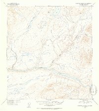
1953 Map of Talkeetna Mountains D-3
USGS Topo · Published 1954About this map
The Susitna River carves a massive glacial path through this subarctic wilderness, serving as the dominant geographic feature of the 1953 landscape. Flowing from east to west across the southern third of the quadrangle, the river is fed by a complex drainage network including Watana Creek and the southern flow of Deadman Creek. To the south, the Fog Lakes and Fog Creek mark a high plateau, illustrating the area's intricate hydrologic pattern of alpine basins and steep-sided valleys. The topography, derived from 1949 aerial photography, captures the interior's character before major modern infrastructure, highlighting named surveyor points like VABM 3467 Lark and the appropriately named Delusion Creek. This survey provides a baseline of the Talkeetna Mountains drainage systems, from the expansive Big Lake in the north to the glacial silt-rich main stem of the Susitna.
Find a feature on this map
8 named features on this map. Tap any name to fly to it.
Don’t see what you’re looking for? This feature index may not catch every label — zoom into the map to look around manually.
Map Details
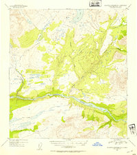
Editions of this 1953 Talkeetna Mountains D-3 Map
2 editions found
Other maps of this area

1950 · Talkeetna Mountains
USGS Topo · 1:250,000

1950 · Healy A-3
USGS Topo · 1:63,360

1950 · Healy A-4
USGS Topo · 1:63,360

1951 · Healy
USGS Topo · 1:250,000

1951 · Talkeetna Mountains C-2
USGS Topo · 1:63,360

1951 · Talkeetna Mountains D-2
USGS Topo · 1:63,360

1951 · Talkeetna Mountains C-4
USGS Topo · 1:63,360

1951 · Talkeetna Mountains D-3
USGS Topo · 1:63,360

1951 · Talkeetna Mountains D-4
USGS Topo · 1:63,360

1951 · Talkeetna Mountains C-3
USGS Topo · 1:63,360