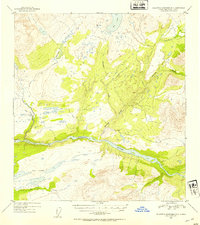
1953 Map of Talkeetna Mountains D-3
USGS Topo · Published 1954About this map
The Susitna River carves a massive glacial valley across this mid-century topographic study, which was compiled using aerial photography from 1949. The landscape is defined by its complex hydrology, where Fog Lakes and Big Lake occupy high benches above the main river channel. Numerous tributaries, including the branching Watana Creek and the long course of Deadman Creek, drain the surrounding uplands, creating a detailed record of the drainage patterns in this part of the Alaska-Third Judicial Division. The absence of roads or permanent structures at the time of the 1953 mapping highlights the area's isolation and reliance on natural watercourses like Delusion Creek and Fog Creek for orientation. This survey provides a baseline of the terrain before later developments, capturing the pristine state of the river valley and its surrounding alpine lakes.
Find a feature on this map
7 named features on this map. Tap any name to fly to it.
Don’t see what you’re looking for? This feature index may not catch every label — zoom into the map to look around manually.
Map Details
Editions of this 1953 Talkeetna Mountains D-3 Map
2 editions found
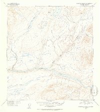
Other maps of this area

1950 · Talkeetna Mountains
USGS Topo · 1:250,000

1950 · Healy A-3
USGS Topo · 1:63,360

1950 · Healy A-4
USGS Topo · 1:63,360

1951 · Healy
USGS Topo · 1:250,000

1951 · Talkeetna Mountains C-2
USGS Topo · 1:63,360

1951 · Talkeetna Mountains D-2
USGS Topo · 1:63,360

1951 · Talkeetna Mountains C-4
USGS Topo · 1:63,360

1951 · Talkeetna Mountains D-3
USGS Topo · 1:63,360

1951 · Talkeetna Mountains D-4
USGS Topo · 1:63,360

1951 · Talkeetna Mountains C-3
USGS Topo · 1:63,360