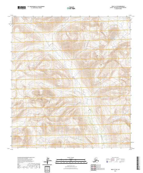
2024 Map of Healy A-4 SE
USGS Topo · Published 2024About this map
Tsusena Creek carves through this remote interior landscape within the Matanuska-Susitna Borough, providing the primary hydrologic character of the terrain. The topography is defined by high alpine elevations and steep drainages, documented here as part of the Public Land Survey System including the intersections of t21s r6w, t21s r5w, t22s r6w, and t22s r5w. This 2024 edition reflects the modern character of this uninhabited wilderness area, showing how the glacial and fluvial processes of the Alaska Range continue to shape the drainage basins of the southern interior.
Find a feature on this map
5 named features on this map. Tap any name to fly to it.
Don’t see what you’re looking for? This feature index may not catch every label — zoom into the map to look around manually.
Map Details
Editions of this 2024 Healy A-4 SE Map
This is the sole edition of this map. No revisions or reprints were ever made.
Other maps of this area

1950 · Talkeetna Mountains
USGS Topo · 1:250,000

1950 · Healy A-3
USGS Topo · 1:63,360

1950 · Healy A-4
USGS Topo · 1:63,360

1951 · Healy
USGS Topo · 1:250,000

1951 · Talkeetna Mountains D-3
USGS Topo · 1:63,360

1951 · Talkeetna Mountains D-4
USGS Topo · 1:63,360

1952 · Healy A-4
USGS Topo · 1:63,360
1952 · Talkeetna Mountains D-4
USGS Topo · 1:63,360
1952 · Healy A-3
USGS Topo · 1:63,360
1953 · Talkeetna Mountains D-3
USGS Topo · 1:63,360