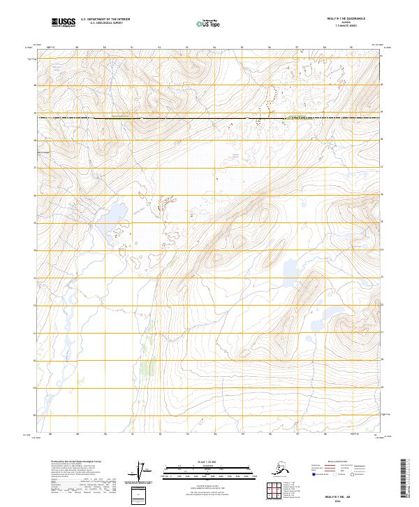
2024 Map of Healy B-1 NE
USGS Topo · Published 2024About this map
The Alaska Range dominates this 2024 quadrangle, where the massive ice flows of the Susitna Glacier and West Fork Glacier shape the high-elevation landscape. The topography is defined by the descent of these glacial bodies into the upper reaches of the Susitna River, which cuts through the southwestern portion of the sheet. This terrain serves as the natural boundary between the Denali Borough and the Matanuska-Susitna Borough, an area devoid of roads or settlements. The survey captures the raw state of this interior wilderness at the southern edge of the Alaska Range, documenting the current extent of ice and glacial meltwater channels as they existed during the 2013 imagery window.
Find a feature on this map
11 named features on this map. Tap any name to fly to it.
Don’t see what you’re looking for? This feature index may not catch every label — zoom into the map to look around manually.
Map Details
Editions of this 2024 Healy B-1 NE Map
This is the sole edition of this map. No revisions or reprints were ever made.
Other maps of this area

1950 · Mount Hayes
USGS Topo · 1:250,000

1950 · Healy B-1
USGS Topo · 1:63,360

1951 · Healy
USGS Topo · 1:250,000

1951 · Mount Hayes
USGS Topo · 1:250,000

1951 · Mount Hayes B-6
USGS Topo · 1:63,360

1951 · Healy C-1
USGS Topo · 1:63,360

1951 · Mount Hayes C-6
USGS Topo · 1:63,360

1952 · Healy B-1
USGS Topo · 1:63,360

1955 · Mount Hayes
USGS Topo · 1:250,000

1956 · Healy
USGS Topo · 1:250,000