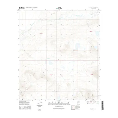
2016 Map of Healy B-1 SE
USGS Topo · Published 2016About this map
East Fork Susitna River cuts across the northern reaches of this Alaskan interior landscape, where glacial waters and shifting channels carve through the high-elevation terrain of the Matanuska-Susitna Borough. The drainage patterns of the Boulder Cr system dominate the central and southern portions of the quadrangle, illustrating the complex hydrology of this subarctic environment. Surveyed by the U.S. Geological Survey, this sheet provides a detailed look at the Public Land Survey System divisions, including t18s r3e, t18s r4e, t19s r3e, and t19s r4e. The map serves as a precise record of the topography and watercourses before further shifts in the riverbed or landscape occur, essential for understanding the remote geography of the upper Susitna basin.
Find a feature on this map
6 named features on this map. Tap any name to fly to it.
Don’t see what you’re looking for? This feature index may not catch every label — zoom into the map to look around manually.
Map Details
Editions of this 2016 Healy B-1 SE Map
This is the sole edition of this map. No revisions or reprints were ever made.
Other maps of this area

1949 · Healy A-1
USGS Topo · 1:63,360

1950 · Mount Hayes
USGS Topo · 1:250,000

1950 · Healy B-1
USGS Topo · 1:63,360

1950 · Mount Hayes A-6
USGS Topo · 1:63,360

1951 · Healy
USGS Topo · 1:250,000

1951 · Mount Hayes
USGS Topo · 1:250,000

1951 · Mount Hayes B-6
USGS Topo · 1:63,360
1952 · Healy A-1
USGS Topo · 1:63,360

1952 · Healy B-1
USGS Topo · 1:63,360

1952 · Mount Hayes A-6
USGS Topo · 1:63,360