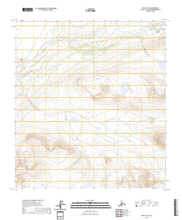
2024 Map of Healy B-1 SE
USGS Topo · Published 2024About this map
East Fork Susitna River and Boulder Creek define the drainage patterns of this high-elevation interior landscape in the eastern Matanuska-Susitna region. The terrain is characterized by steep contour gradients and high-alpine glacial valleys, with watercourses cutting through massive geological formations. Mapping here relies on precise data from the U.S. Department of the Interior and the U.S. Geological Survey to document a region where human infrastructure is largely absent in favor of raw natural hydrology. The elevation data reveals the stark relief of the Alaskan wilderness, providing an essential record for those studying the physical geography of the Susitna River's upper reaches.
Find a feature on this map
6 named features on this map. Tap any name to fly to it.
Don’t see what you’re looking for? This feature index may not catch every label — zoom into the map to look around manually.
Map Details
Editions of this 2024 Healy B-1 SE Map
This is the sole edition of this map. No revisions or reprints were ever made.
Other maps of this area

1949 · Healy A-1
USGS Topo · 1:63,360

1950 · Mount Hayes
USGS Topo · 1:250,000

1950 · Healy B-1
USGS Topo · 1:63,360

1950 · Mount Hayes A-6
USGS Topo · 1:63,360

1951 · Healy
USGS Topo · 1:250,000

1951 · Mount Hayes
USGS Topo · 1:250,000

1951 · Mount Hayes B-6
USGS Topo · 1:63,360
1952 · Healy A-1
USGS Topo · 1:63,360

1952 · Healy B-1
USGS Topo · 1:63,360

1952 · Mount Hayes A-6
USGS Topo · 1:63,360