
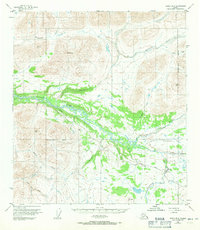
1950 Map of Healy B-3
USGS Topo · Published 1964About this map
The Denali Highway cuts through this Alaskan interior landscape, providing a critical transportation link through the mountains south of the Alaska Range. Following the valley of the Nenana River, the road passes by the Brushkana Campground and a remote Landing Strip, which served as vital access points in a region largely defined by its glacial drainages and high peaks. The terrain is marked by numerous watercourses, including Brushkana Creek, Wells Creek, and Seattle Creek, which flow through deep valleys between summits like Pyramid Pk.
Find a feature on this map
19 named features on this map. Tap any name to fly to it.
Don’t see what you’re looking for? This feature index may not catch every label — zoom into the map to look around manually.
Map Details
Editions of this 1950 Healy B-3 Map
2 editions found
Other maps of this area

1949 · Healy B-4
USGS Topo · 1:63,360

1949 · Healy C-3
USGS Topo · 1:63,360

1949 · Healy B-2
USGS Topo · 1:63,360

1950 · Healy C-4
USGS Topo · 1:63,360

1950 · Healy A-3
USGS Topo · 1:63,360

1950 · Healy A-4
USGS Topo · 1:63,360

1951 · Healy
USGS Topo · 1:250,000

1951 · Healy B-4
USGS Topo · 1:63,360

1951 · Healy C-2
USGS Topo · 1:63,360

1951 · Healy A-2
USGS Topo · 1:63,360