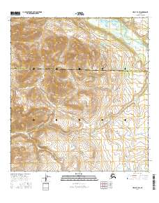
2016 Map of Healy B-3 SW
USGS Topo · Published 2016About this map
Cantwell serves as the primary focal point of this 2016 survey, situated where the high-altitude interior terrain transitions between the Denali Borough and Matanuska-Susitna Borough. The landscape is dominated by a complex network of alpine drainage systems, most notably the north-flowing Nenana River and the meandering E Fork Jack River. These waterways, along with numerous mountain streams like Seattle Cr and Lily Cr, reveal the intricate topographical patterns of the Alaska Range foothills.
Find a feature on this map
12 named features on this map. Tap any name to fly to it.
Don’t see what you’re looking for? This feature index may not catch every label — zoom into the map to look around manually.
Map Details
Editions of this 2016 Healy B-3 SW Map
This is the sole edition of this map. No revisions or reprints were ever made.
Other maps of this area

1949 · Healy B-4
USGS Topo · 1:63,360

1950 · Healy A-3
USGS Topo · 1:63,360

1950 · Healy B-3
USGS Topo · 1:63,360

1950 · Healy A-4
USGS Topo · 1:63,360

1951 · Healy
USGS Topo · 1:250,000

1951 · Healy B-4
USGS Topo · 1:63,360

1952 · Healy A-4
USGS Topo · 1:63,360
1952 · Healy A-3
USGS Topo · 1:63,360
1952 · Healy B-3
USGS Topo · 1:63,360

1956 · Healy
USGS Topo · 1:250,000