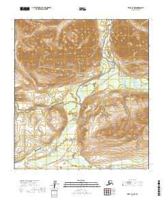
2019 Map of Healy B-4 NW
USGS Topo · Published 2019About this map
Cantwell serves as the primary gateway for this interior Alaskan landscape, situated at the junction where the Denali Highway meets the Parks Highway. This region is defined by the powerful convergence of the Nenana River and the Jack River, creating a corridor that has historically dictated transportation routes through the mountainous terrain. The map captures the transition between the settlement area and the expansive wilderness of Denali National Park, highlighting the intersection of local infrastructure and protected lands. Local aviation and road networks, including the Cantwell Airport and Cantwell Road, illustrate the town's role as a vital supply point. The topography rises sharply from the river valleys toward landmarks like Panorama Mtn and the Reindeer Hills, while numerous smaller waterways such as Slime Cr and Windy Creek drain the surrounding uplands.
Find a feature on this map
31 named features on this map. Tap any name to fly to it.
Don’t see what you’re looking for? This feature index may not catch every label — zoom into the map to look around manually.
Map Details
Editions of this 2019 Healy B-4 NW Map
This is the sole edition of this map. No revisions or reprints were ever made.
Other maps of this area

1949 · Healy B-4
USGS Topo · 1:63,360

1950 · Healy C-4
USGS Topo · 1:63,360

1950 · Healy B-5
USGS Topo · 1:63,360

1951 · Healy
USGS Topo · 1:250,000

1951 · Healy B-5
USGS Topo · 1:63,360

1951 · Healy B-4
USGS Topo · 1:63,360

1952 · Healy C-5
USGS Topo · 1:63,360
1952 · Healy C-4
USGS Topo · 1:63,360

1953 · Healy C-5
USGS Topo · 1:63,360

1953 · Healy B-5
USGS Topo · 1:63,360