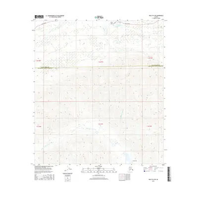
2016 Map of Healy B-4 SW
USGS Topo · Published 2016About this map
Caribou Pass sits at the heart of this high-latitude landscape, where the drainage systems of the Jack River and the Middle Fork Chulitna River converge across the Denali Borough Matanuska-Susitna Borough line. The map captures a critical transit corridor in the Alaskan interior, showing the intersection of the Parks Highway and the Denali Highway near the northern boundary. Small-scale aviation and local access are represented by the Golden North Airfield and residential spurs like David Drive and Tisa Drive. The contrast between the marshy lowlands surrounding Drashner Lake and the steep elevation changes toward the southern passes illustrates the topographical transition from river valley to the peaks of the Alaska Range.
Find a feature on this map
15 named features on this map. Tap any name to fly to it.
Don’t see what you’re looking for? This feature index may not catch every label — zoom into the map to look around manually.
Map Details
Editions of this 2016 Healy B-4 SW Map
This is the sole edition of this map. No revisions or reprints were ever made.
Other maps of this area

1949 · Healy B-4
USGS Topo · 1:63,360

1950 · Healy A-4
USGS Topo · 1:63,360

1950 · Healy A-5
USGS Topo · 1:63,360

1950 · Healy B-5
USGS Topo · 1:63,360

1951 · Healy
USGS Topo · 1:250,000

1951 · Healy B-5
USGS Topo · 1:63,360

1951 · Healy B-4
USGS Topo · 1:63,360

1952 · Healy A-4
USGS Topo · 1:63,360

1952 · Healy A-5
USGS Topo · 1:63,360

1953 · Healy B-5
USGS Topo · 1:63,360